Limiting GIS use to a digital replacement of paper maps is a profound underutilization—a lost advantage to address a challenging environment.
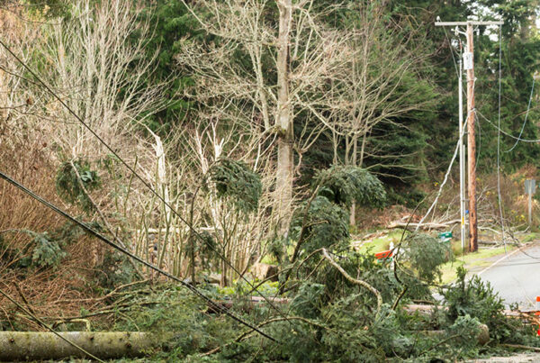
Overcoming the challenges that utilities face today seems overwhelming at times. Yet, utility issues and solutions all have one thing in common: utility concerns are spatial. It’s hard to think of a utility process that ignores location. Around the globe, utilities use maps. Why? Because utilities work better when using location intelligence.
Virtually every utility uses geographic information system (GIS) technology as a foundation for mapping. However, limiting GIS use to a digital replacement of paper maps is a profound underutilization—a lost advantage to address a challenging environment.
Changes in the utility environment and the explosion of data both demand better ways of managing, examining and communicating information. The energy industry asks for new digital tools that show an inclusive picture and provide powerful insights…insights that include exceptional visualization on any device, anywhere, at any time.
A modern GIS is such a tool — an extensive information system that enables new results—solutions that devour underutilized data, harness analytics and run on any device.
“Understanding precedes action.” Jack Dangermond, Founder and President, Esri
A modern GIS approach must be comprehensive…comprehensive in that it contains all the elements needed to solve utility challenges, not only make conventional maps faster. A modern GIS employs advanced data models, consumes external data, and uses the latest artificial intelligence and machine learning tools. In addition to maintaining essential information, it also analyzes and distributes it to everyone that needs business intelligence.
Getting the most out of a comprehensive GIS requires a new way of thinking. It demands a method of problem-solving that integrates all the information available to a utility. This process is called “the geographic approach,” which leads to a comprehensive understanding and sound decision-making.
The geographic approach sets up a framework for action applying knowledge in meaningful ways directly into a utility’s workflows. Since the majority of work involves location, GIS enables this approach. It allows utilities to measure things, measure them in very focused ways, make maps, visualize and help people understand. It’s also an environment in which engineers and planners can design using this geographic understanding and make better decisions.
Whether engineering, facility, real-time, network or environmental data, it’s science-based. GIS and the geographic approach bring this information together and help utilities recognize–and predict.
Data-driven predictions form the foundation of decision-making:
- What are the most significant risks to resiliency?
- What factors are affecting asset performance and longevity?
- Where are the equity concerns?
The answers to these questions offer examples of actionable business intelligence.
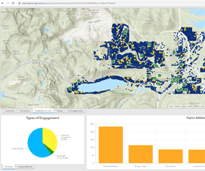
Business intelligence comes from examining raw data through the lens of location. Analytics reveals the secrets in data and the evaluation of trends. It’s about revealing those secrets—discovering new understanding– unearthing new insights that are not visible using conventional means. Such insights dramatically magnify business value.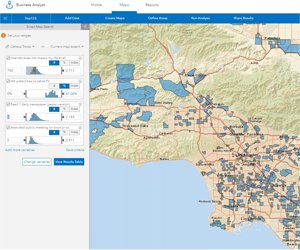
Spatial analytics release more significant insights. They detect patterns and correlations. They uncover relationships that simple reporting cannot find.
A modern GIS furnishes uplifting capabilities such as spatial analysis, machine learning, big data analytics and image processing. The results are easily exploited with engaging apps personalized to each user’s role. They provide focused capabilities and align with how people work today.
As the requirements for analytics have evolved, so has ArcGIS. As a result, ArcGIS delivers the power to increase effectiveness throughout a utility. To learn more about how the ArcGIS geographic approach boosts analytics, visit Esri’s Business Intelligence webpage.
Pat Hohl is the director of electric industry solutions at Esri.